Smart phone cameras are really good these days, and the ones on the Apple iPhone are certainly at or near the front of the pack.
The iPhone 12 Pro has a new sensor that includes depth scanning (LIDAR technology, to be specific). The system emits infrared light pulses that reflect off of surfaces and return to the sensor. The “mesh” of points that returns can be used to map distances. The primary use is to improve the speed and accuracy of the camera’s focus, particularly in low light situations. But you can also use the tech to map the shapes and sizes of objects, and even entire rooms, with a surprising degree of accuracy.
App developers are just in the beginning stages of some amazing work to take advantage of this technology and create augmented 3D worlds, simulations and even measurements.
But OmniSurf3D is already there…
Mapping surfaces with OmniSurf3D
Out of the box, OmniSurf3D can load LIDAR and Virtual Reality files with image overlays (GLB and OBJ file types, even Pixar’s USDZ files). OmniSurf3D lets you view an actual image overlaid right onto the surface data, so you can calculate heights while viewing the actual surface (rather than a wire-grid or false-color representation).
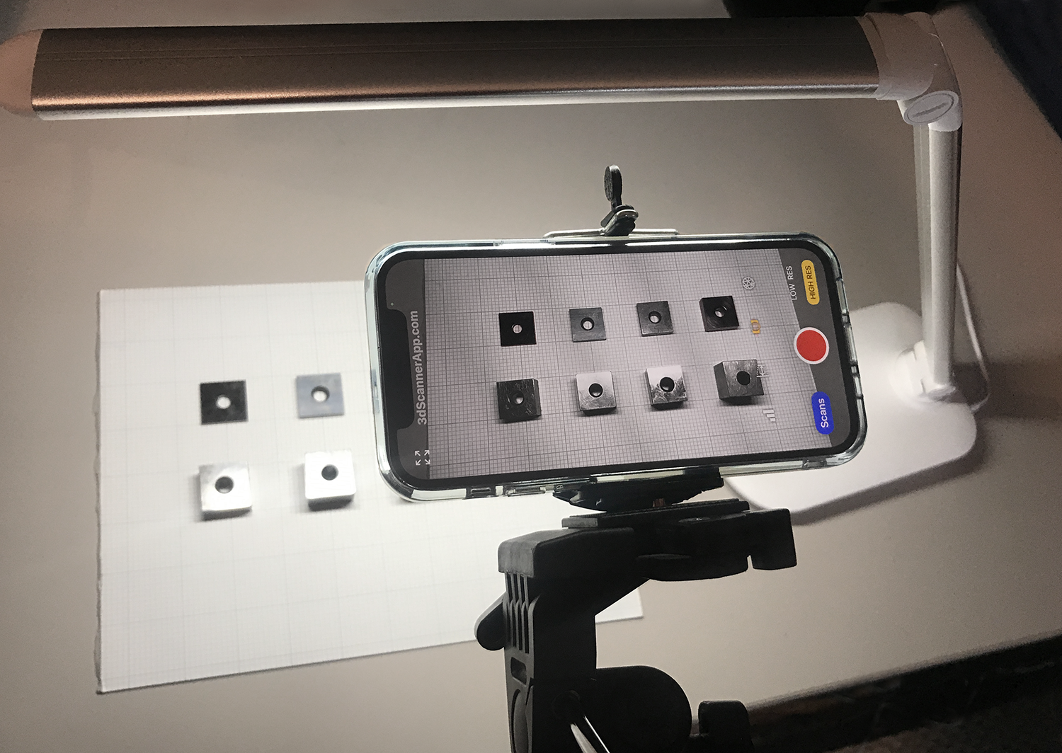
We decided to put the tech to the test, using a series of gage blocks as our subjects. The test setup is shown above (including the very high-end lighting rig!).
The gage blocks ranged in size as follows:
- 0.1” (2.54 mm)
- 0.2” (5.08 mm)
- 0.3” (7.62 mm)
- 0.4” (10.16 mm)
- 0.5” (12.7 mm)
- 0.7” (17.78 mm)
- 0.8” (20.32 mm)
- 1.0” (25.4 mm)
After acquiring the image with the iPhone we imported the data into OmniSurf3D. We then removed overall form from the data (the desk surface is fairly flat, but this took out the last bit of curvature). The cross section cursor made it easy to read the heights of the blocks. Here is the data and overlay image, as shown in OmniSurf3D:
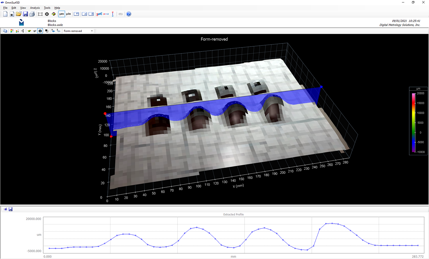
This method works surprisingly well, with a decent degree of accuracy. I wouldn’t necessarily recommend it for actual metrology work, but it is a good demonstration of how far consumer-grade electronics have come. With this quick study we can get also get sense of the iPhone LIDAR’s lateral resolution. It’s far from what we are used to in terms of surface metrology instruments and causes the image overlay to become very pixelated. Nonetheless, this demonstrates how much you can do with OmniSurf3D. It also demonstrates that OmniSurf3D can handle data from just about any kind of surface measuring device—even an iPhone 12!
Want to try it for yourself? Download a demo version of OmniSurf3D.
To download the dataset that we used, right-click on the link below and choose “Save Link As” or “Save File As.”
www.digitalmetrology.com/Datasets/Blocks.os3d
We have lots of tutorial videos available through the website to help you get started using the software, and you can contact us if you need a little guidance to get going.